countries and territories
Background
Introducing natural enemies to control invasive weeds in Pacific Island countries and territories (PICTs) is often the only practical solution to this growing problem. Current climate change scenarios predict more disruption to biodiversity, ecosystem services, primary production, and human health and safety in the future as the speed of weed invasions across the PICTs increases. While natural enemies of weeds have an excellent weed control track record, monitoring weed populations and evaluating impacts following introductions is challenging especially for large tree species or vines that grow in canopies.
Approach and methods
We tested various remote sensing monitoring and evaluation techniques including consideration of scale, spectra, timing, and texture, to develop a practical solution for PICTs
wanting to assess their own weed control projects. The method we recommend after testing these techniques includes flying 10 cm resolution aeroplane imagery over target areas and using artificial intelligence deep learning approaches developed by Manaaki Whenua – Landcare Research (MWLR) in QGIS (commonly used free GIS software) to map distinctive target species.
Results
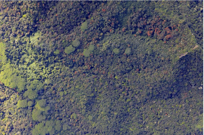
- We have made maps of African tulip tree (Spathodea campanulata) and tamaligi/albizia (Falcataria moluccana) occurrence in Rarotonga as an example of the types of baseline maps that can be produced and used for future comparisons. In addition to this, we used high-resolution (1–4 cm) imagery captured at a selection of smaller drone test sites within this area to collect tree-scale statistics for detailed future comparisons and for evaluating the impacts of natural enemies of weeds. Preliminary drone footage from Niue showed the potential for mapping taro vine (Epipremnum pinnatum) using unique spectral signatures.
• To help detect natural weed enemy presence and density we captured very high resolution (< 0.5 cm) drone imagery over individual tree canopies at the same test sites to look for damage on an individual leaf scale. We also trialled a drone-based canopy sampler to collect vegetative material from tall trees, but it proved difficult to operate and would not be suitable for collecting large numbers of samples by an inexperienced operator
Recommendations
For ongoing monitoring and evaluation of natural enemies to control invasive weeds in Rarotonga and other PICTs we recommend the following:
- Rarotongan National Environmental Service to support re-flying island-scale and drone site imagery in 5–10 years’ time to assess natural enemy impacts. To do this the practicality of managing image acquisition and assessment work locally versus external contracting needs to be determined. Tools and skills then need to be acquired for locally managed work and external contractors sourced for remaining tasks.
- Rarotonga National Environmental Service to consider the potential for mapping additional invasive weed species from the existing aeroplane imagery.
- Other PICTs to consider the collection of similar baseline imagery where information on invasive weed spread distribution and impacts of control efforts is required.
