Through a funding collaboration between the Ministry for Primary Industries, the Ministry for the Environment, and 12 regional councils, Manaaki Whenua – Landcare Research has completed an extra 507,000 ha of new soil mapping coverage across some of New Zealand’s best food-producing land. A further 363,000 ha of legacy mapping was replaced with a new soil survey. The partnership is on track to deliver a further 700,000 hectares of new mapping over the next year.
The newly mapped areas in this update to S-map include:
- 201,660 ha in Wellington – Wairarapa east coast
- 9,656 ha in Marlborough – upper Wairau River valley
- 27,655 ha in Tasman – Tapawera valley and Moutere River valley
- 64,625 ha in Otago – Moa Flats
- 45,999 ha in Southland – Chatton (north of Gore) and Curio Bay, Catlins
- 158,000 ha in Northland – Kaikohe, Dargaville and Pouto Peninsula.
Updated mapping of lower-quality legacy mapping includes:
- 123,698 ha in Bay of Plenty – Kaituna and Maketu water management areas
- 240,000 ha in Tasman – Motueka hill country.
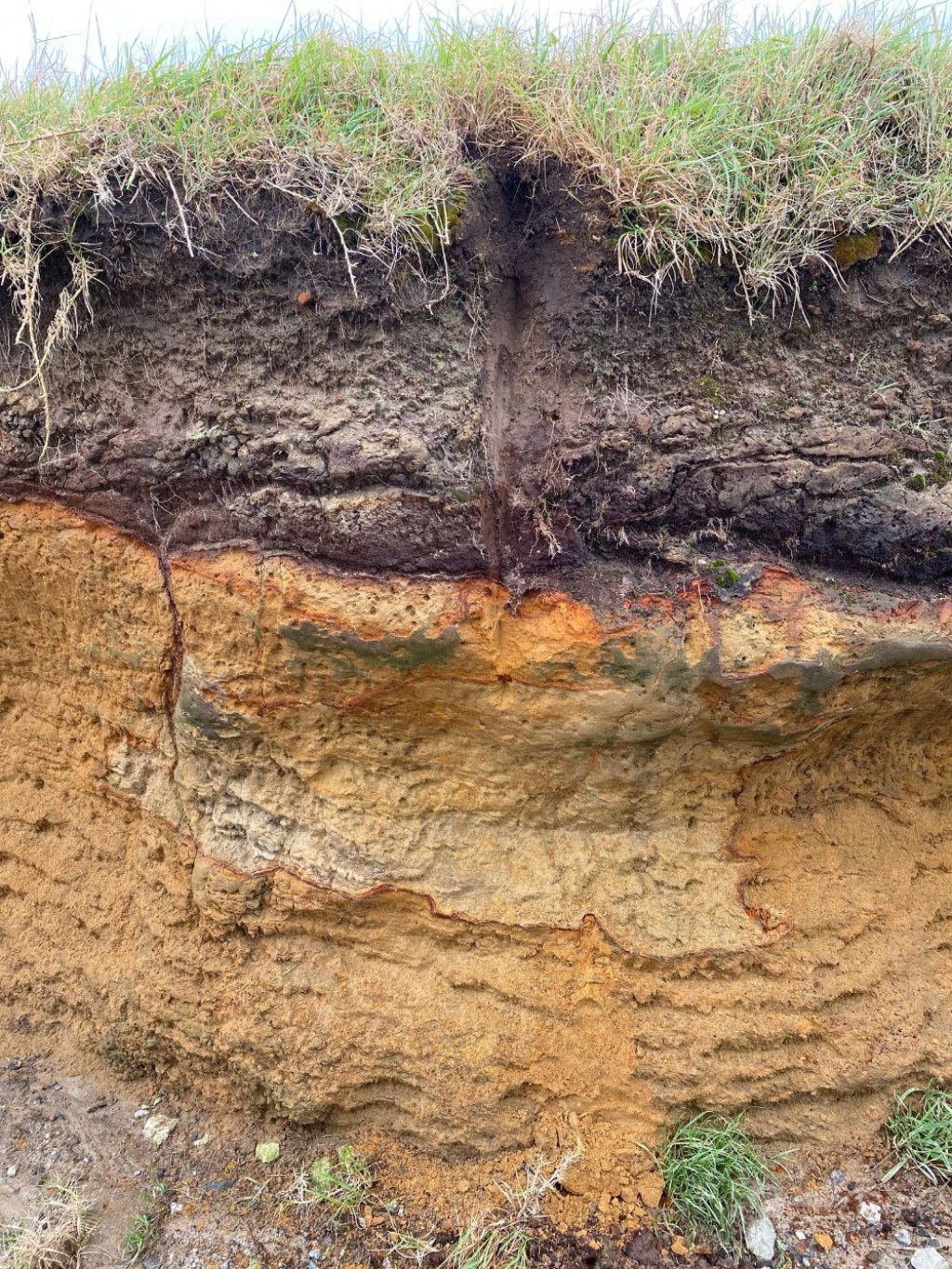
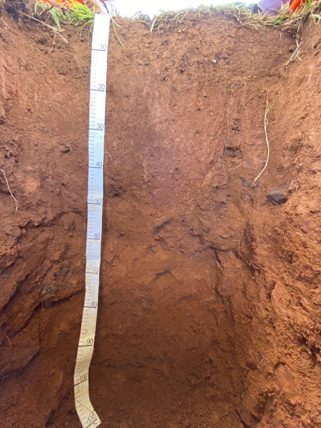
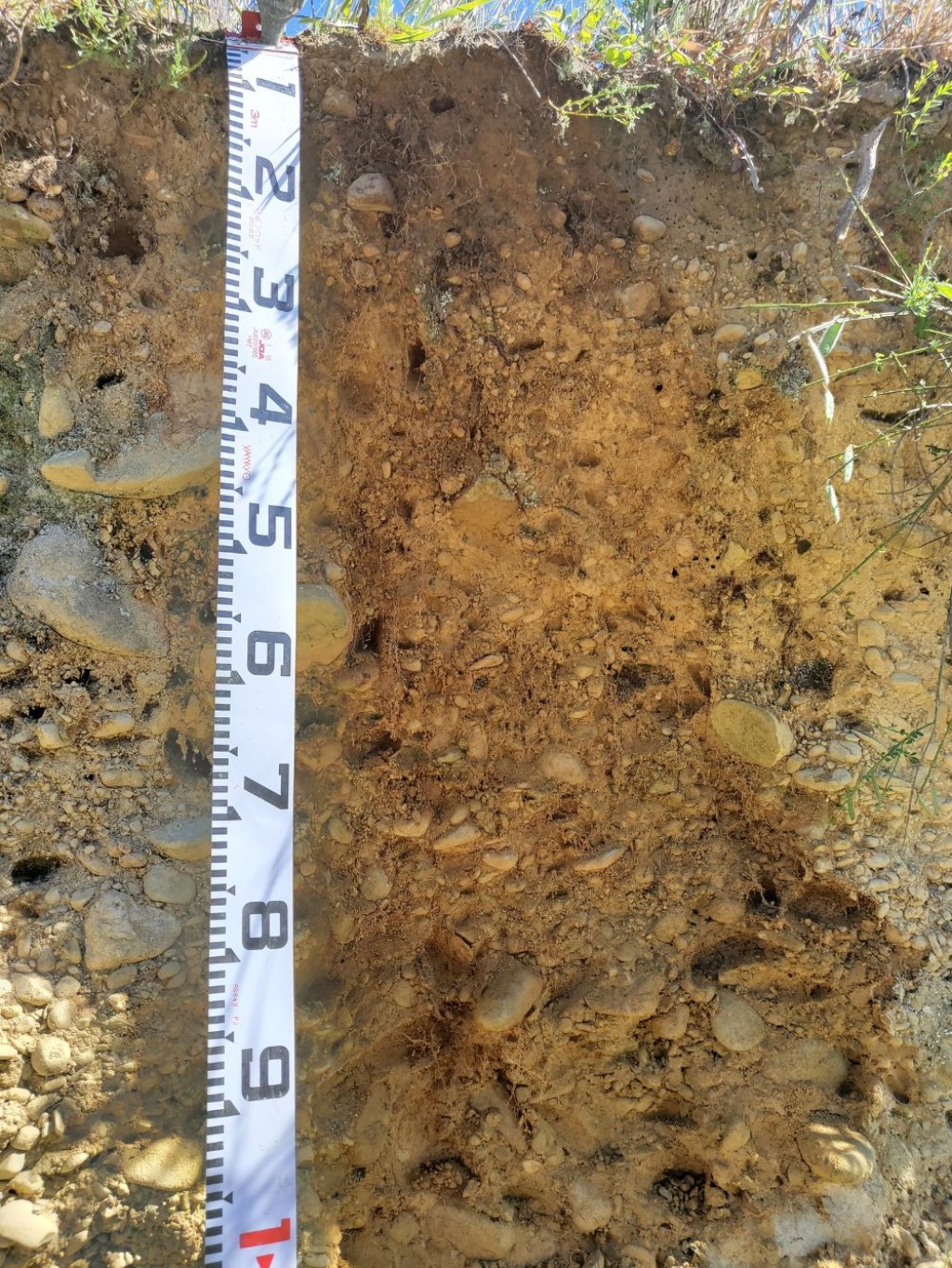
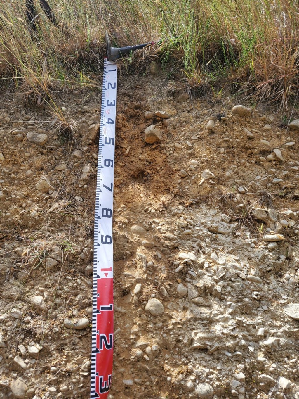
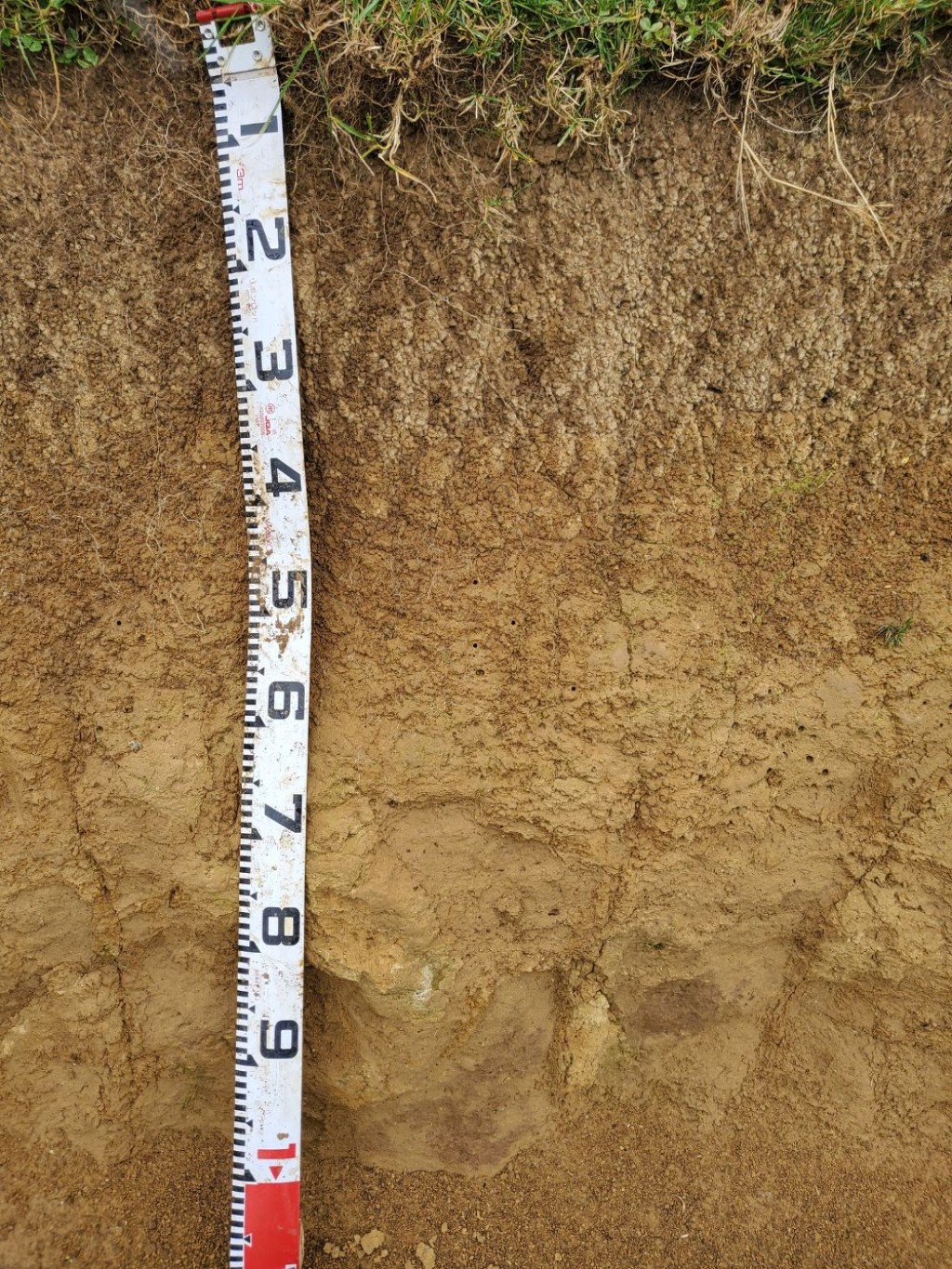
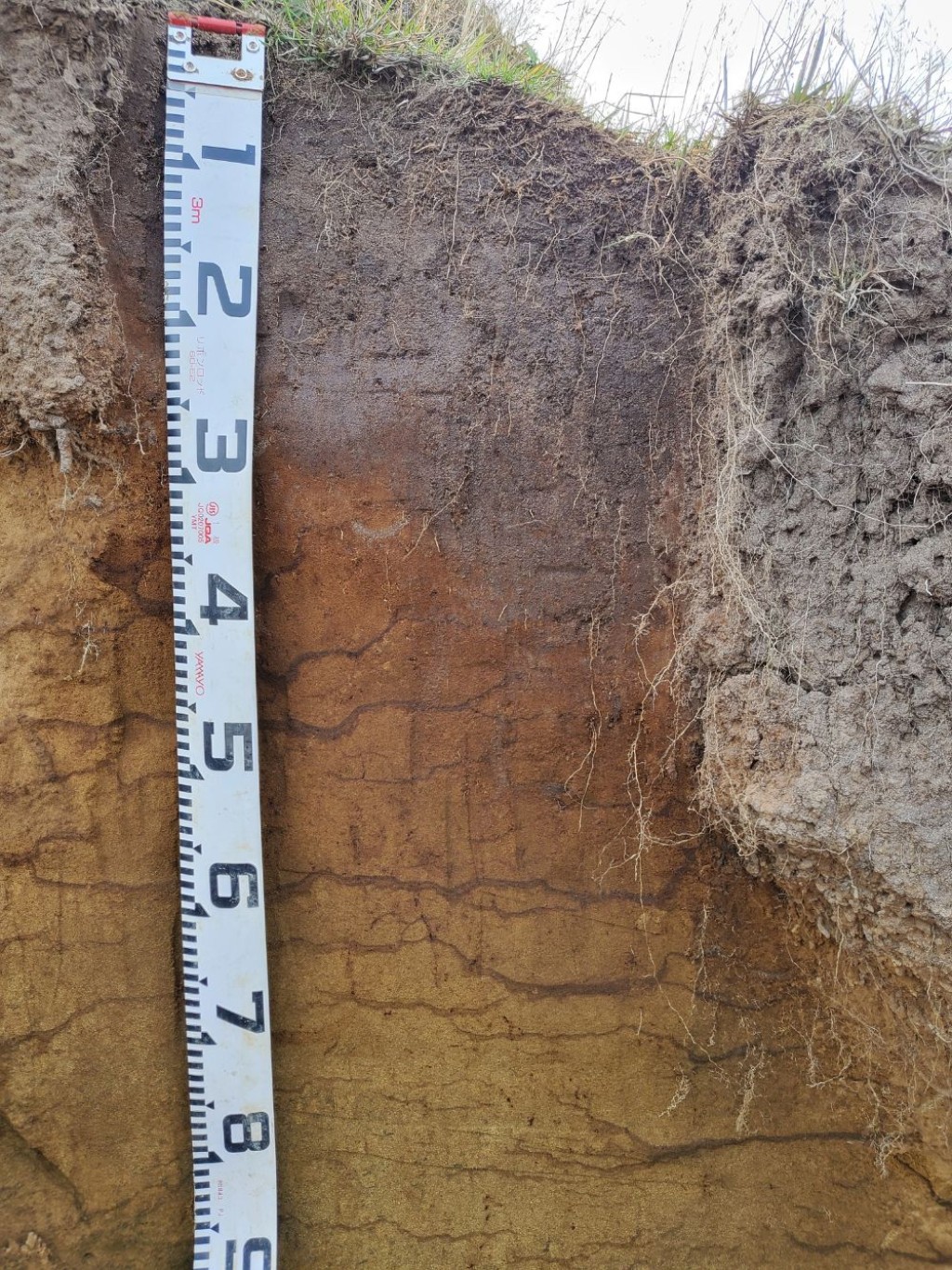
Pedologist Emily McKay, who led the Northland soil survey with senior researcher Dr Scott Fraser, highlights the highly interesting and variable soil types we are mapping across New Zealand. ‘We encountered the famous Kerikeri Oxidic soils, and Allophanic soils formed on young basalt flows, both really valuable for horticulture,’ says Emily. ‘The most interesting feature so far among many of the Ultic and Podzol soils is the presence of a silica-rich layer that makes your auger squeak and spin in circles, and they are some of the most difficult soils for farmers to manage.’
A gallery of some of the fascinating soils we have mapped across our different surveys over the last year is presented in the figure below.
Developed and updated by Manaaki Whenua – Landcare Research, S-map provides the best available soil survey data for New Zealand. It displays basic soil property data such as depth, stoniness, and clay content, as well as more complex data such as water-holding capacity and nitrogen-leaching risk, and provides comprehensive and accurate soil information to support the sustainable management of our soil resource. There are also tools that help land managers and consultants find the S-map soil type that best matches on-farm field observations.
Soil scientist Dr Sam Carrick says richer soils data mean much better modelling assumptions, which in turn support better decision-making on the ground. ‘A major focus has been the provision of soil hydrology information, soil attributes that have significant effects on farmers’ nutrient budget calculations,’ says Sam. ‘More accurate soil moisture information will lead to better knowledge of irrigation demand and nutrient losses.’

