Updated estimates of soil water retention in S-map
Predictive models, termed pedotransfer functions (PTFs), are used to extrapolate from these measured reference sites to the wider range of S-map soils. PTFs underpin the S-map information system. Hydrological properties are usually estimated using PTFs, because it can cost around $10,000 to dig a pit and do all the laboratory analyses to measure the full soil water retention curve. This curve provides information on the total available water in each soil horizon, and these are summed to provide the profile available water (PAW), with PAW to 60 cm used by tools such as OverseerFM. Soils with a low PAW can provide less water to plants than those with a high PAW. The latter tend to be deep, silty, stone-free soils, and the former might be sandy, shallow or stony soils.
In April 2024 the water retention curve PTF was updated. (It was last updated in 2020.) MBIE Endeavour research programme funding, together with the Ministry for Primary Industries and regional council S-map expansion partnerships, has enabled additional collection of measured reference site data, from which the model is derived. A gap analysis led to efforts to sample more soils with previously low representation in the NSDR, particularly on Pumice, Granular and Allophanic soils.
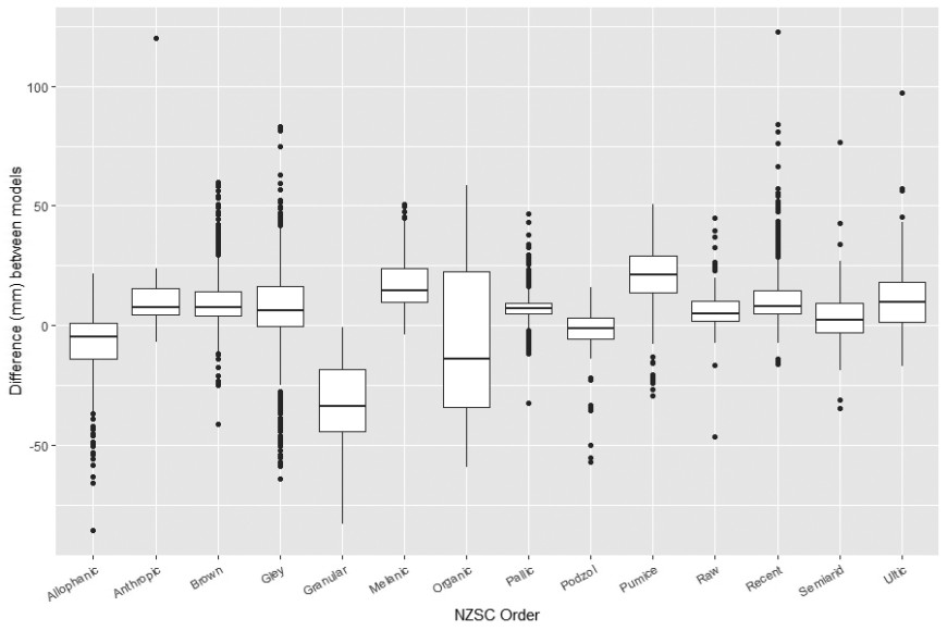
The updated model is based on just under 6,000 samples (on 796 sites) held in the NSDR, compared to 4,641 (on 684 sites) in the 2020 model. A generalised additive model (GAM) beta response model has been developed, as described by McNeill et al. (2024). Notable improvements in the new PTF include better results for some soil orders (especially Granular and Pumice soils) and more reliable predictions when the model is extrapolated to the whole of New Zealand. Default values for the Organic soils horizons have been replaced by a new simple prediction model.

Figure 1. Difference in estimates of PAW to 60 cm between the new water retention model and previous estimates.
Predictive models, termed pedotransfer functions (PTFs), are used to extrapolate from these measured reference sites to the wider range of S-map soils. PTFs underpin the S-map information system. Hydrological properties are usually estimated using PTFs, because it can cost around $10,000 to dig a pit and do all the laboratory analyses to measure the full soil water retention curve. This curve provides information on the total available water in each soil horizon, and these are summed to provide the profile available water (PAW), with PAW to 60 cm used by tools such as OverseerFM. Soils with a low PAW can provide less water to plants than those with a high PAW. The latter tend to be deep, silty, stone-free soils, and the former might be sandy, shallow or stony soils.
In April 2024 the water retention curve PTF was updated. (It was last updated in 2020.) MBIE Endeavour research programme funding, together with the Ministry for Primary Industries and regional council S-map expansion partnerships, has enabled additional collection of measured reference site data, from which the model is derived. A gap analysis led to efforts to sample more soils with previously low representation in the NSDR, particularly on Pumice, Granular and Allophanic soils.
The updated model is based on just under 6,000 samples (on 796 sites) held in the NSDR, compared to 4,641 (on 684 sites) in the 2020 model. A generalised additive model (GAM) beta response model has been developed, as described by McNeill et al. (2024). Notable improvements in the new PTF include better results for some soil orders (especially Granular and Pumice soils) and more reliable predictions when the model is extrapolated to the whole of New Zealand. Default values for the Organic soils horizons have been replaced by a new simple prediction model.

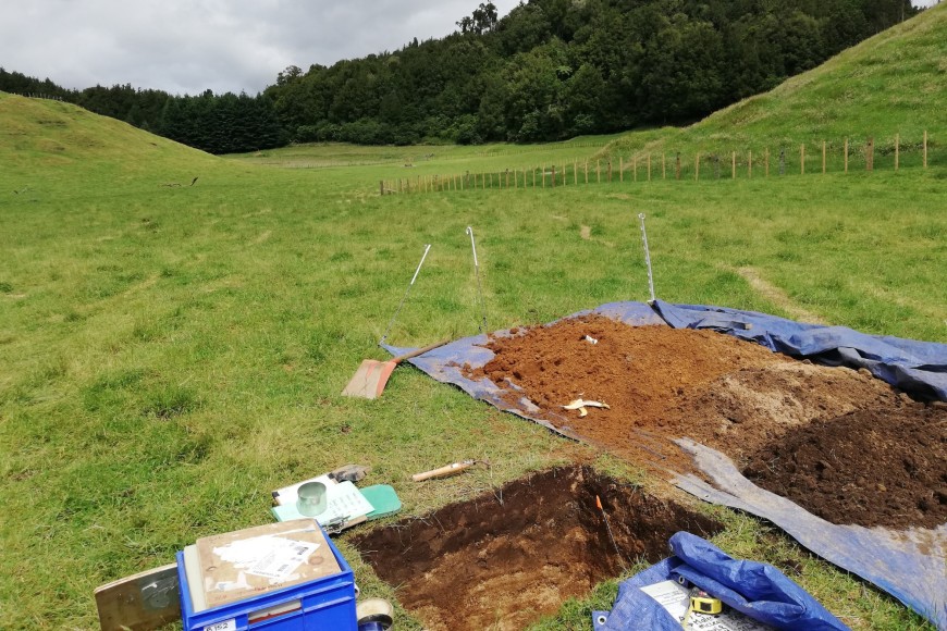
Figure 2. Soil sampling pit preparation near Rotorua. (Photo: Veronica Penny)

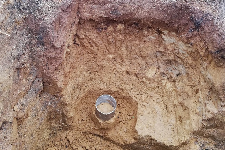
Figure 3. Preparing to hand carve an undisturbed soil core at 1 m depth for measuring soil water-holding capacity. (Photo: Veronica Penny)
Reference
McNeill S, Lilburne L, Vickers S, Webb T, Carrick S 2024. An improved pedotransfer function for soil hydrological properties in New Zealand. Applied Sciences 14(10): 3997.
Authors and key contacts


